AIRSCAN
The LOCATE project studied the locomotion and hunting behaviours of large African carnivores. AIRSCAN grew out of that project and makes available the aerial survey and data acquisition airplane.

Challenge
During its first deployment in the LOCATE project, the aircraft allowed us to understand more about behaviour and locomotion in wild, free-ranging animals in southern Africa. The on-board technology helped reveal new insights into how animals interact with their natural environment, which will aid conservation and land management.
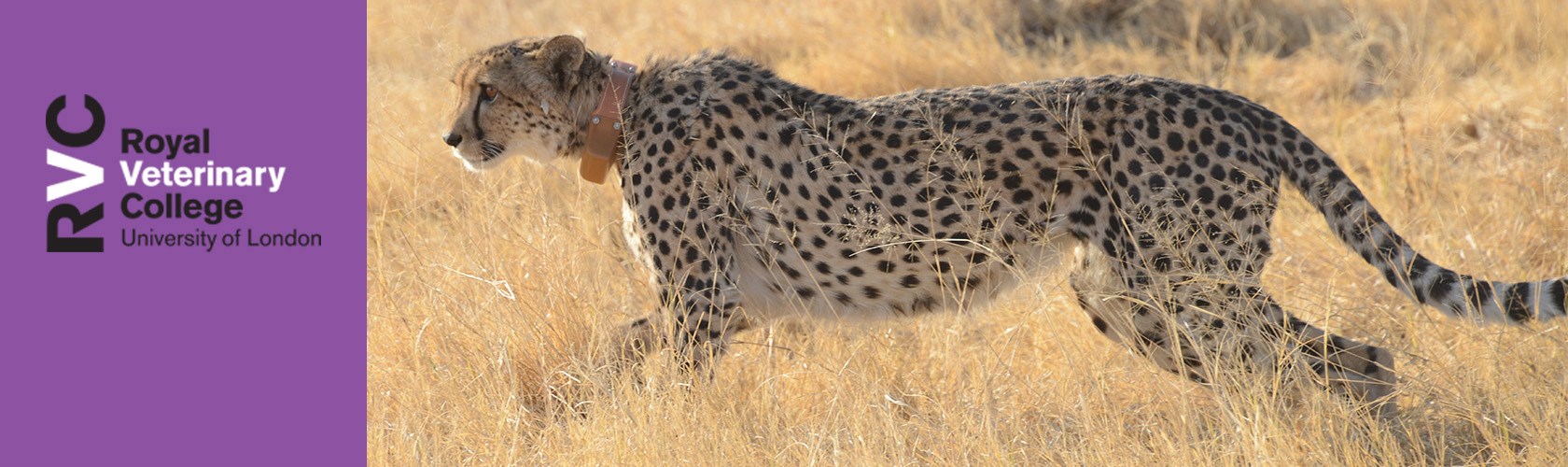
The modified aircraft was originally built for studying large African carnivores and their prey in the savannah of northern Botswana. The researchers developed new ways of recording the detailed movements of these animals without disturbing them, using our wildlife tracking collars. From the air, we can film hunts using high speed video cameras which 'lock on' to the collars, thus capturing in detail the manoeuvring of the hunt that would be impossible using a hand-held camera or from the ground.
Solution
As our subject animals are wild and free-ranging, they move and are distributed over a massive study area. Our plane saves us driving all over the savannah to locate and get close enough to the animals to download collar data and benefits them as well because we can fly within 200-300 metres of them to pick up biomechanics data and upload new collar firmware without interfering in their natural behaviour.

To examine how the animals interact with their natural environment and potentially utilise land features, the plane carries a LiDAR system and medium-format survey camera to perform aerial surveys. The scan data is reconstructed as a 3D point cloud and creates a detailed map of the ground, showing the vegetation, areas of water, tracks on the ground, and terrain features such as dips and hollows, termite mounds and mud flats. Collar data from a hunt can be overlaid on these scans to visualise where and at what speed predator or prey moved over the terrain during a chase, and how the animal may have utilised land features to its advantage.
The plane is a Groppo Trail, bought as a kit and built by us specifically for our research. We chose this model for several reasons, including:
- It is a small aircraft of low running cost and conventional design – meaning that the aircraft is easily modified to equip with camera equipment and aerial LiDAR.
- The tandem seating arrangement and high wings allow good visibility of the ground.
- The benign handling and low stall speed are ideal for wildlife tracking.
- Folding wings make it easy to store, trailer and ship in a 20-foot shipping container to Botswana and back.
- The UK supplier, Graham Smith, has an excellent reputation for supporting self-builders as he is a very experienced aircraft builder and pilot.
Impact
Following the success of our modified research aircraft in our LOCATE project, the AIRSCAN project allows us to commercialise and make available the modifications developed for a modular, single-operator aerial survey and data acquisition airplane, the Trail ADAP. The potential users for this technologically advanced yet undemanding aerial data acquisition platform include government, NGOs, companies and individuals, with applications ranging from mapping, survey data collection, conservation, academic research and many more.
Partners
We thank the European Research Council for funding this research.
